Precision technology, put to work on your farm
WHAT WE DO
From real‑time spot spraying to high‑resolution drone weed mapping, we help you lower your inputs, protect your margins and farm more sustainably.
AGRICHECK - COMPLIANCE AT EVERY TURN
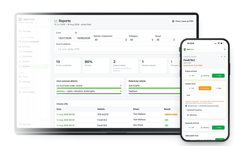
Daily checks,
done properly
AgriCheck turns the daily walk-around into something your team will actually do — and something you can prove. Drivers check tractors, trailers, sprayers and implements from their phone in the yard, snapping a photo of anything wrong. Faults land straight with the office, critical ones stop the machine until you've signed the fix off, and every check is timestamped and attributable — ready for Red Tractor audits or insurers. Built for farmers.

Example weed map we produce — detected weeds highlighted for targeted spraying.
WEED MAPPING
Know exactly where the weeds are
We turn drone imagery into clear, field‑ready weed maps — pinpointing pressure across every field so you treat only what needs treating and plan variable‑rate applications with confidence.
High-resolution aerial weed & crop mapping.
Application maps ready for your sprayer or spreader.
Flown by fully licensed FieldCraft drone operators.
UK DEALER OF CARBON BEE SPOT SPRAY SOLUTIONS
Smart Striker-X — find out how much you could save
Mounted on your existing sprayer, the Smart Striker‑X uses hyperspectral cameras and on‑board AI to detect and target weeds in real time — green‑on‑green and green‑on‑brown.
Cut herbicide significantly — spray the weed, not the field.
Retrofits to your sprayer — any boom, any size.
Full UK supply, fitting & support from FieldCraft Technologies.

Smart Striker-X in the field — green-on-brown & green-on-green detection means only the weeds get sprayed.


Our DJI Matrice 300 RTK & DJI Mavic M3M - flown by fully licensed FieldCraft Operators
DRONE SERVICES
See your fields from a whole new angle
Our fully licensed pilots fly DJI Matrice 300 RTK & DJI Mavic M3M aircraft to deliver fast, accurate aerial intelligence — from weed mapping, plant counts and size to crop-damage assessment.
Weed mapping and precscription file generation
Plant count and size reports
Crop health and variable rate prescriptions
CULTIWISE
Sometimes, Less is More
CuliWise allows you to use high resolution drone imagery, AI detection and mapping to generate spot spray maps, varibale rate plans and much more. Free to try!
Cut herbicide significantly — spray the weed, not the field.
Plans made to tailor your scenario — you're in control
Free to try from FieldCraft Technologies.

CultiWise spot spray plan being used in green on green scenario
From the field
BLOGS
We speak to industry experts to give you sound advice on precision topics.